


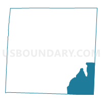
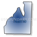
Voting District PROS, Caswell County, North Carolina
About
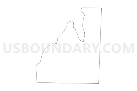
Outline

Summary
| Unique Area Identifier | 639607 |
| Name | Voting District PROS |
| County | Caswell County |
| State | North Carolina |
| Area (square miles) | 33.30 |
| Land Area (square miles) | 32.58 |
| Water Area (square miles) | 0.72 |
| % of Land Area | 97.83 |
| % of Water Area | 2.17 |
| Latitude of the Internal Point | 36.28634780 |
| Longtitude of the Internal Point | -79.19814990 |
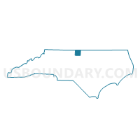
Maps

Graphs
Select a template below for downloading or customizing gragh for Voting District PROS, Caswell County, North Carolina


Neighbors
Neighoring Voting District (by Name) Neighboring Voting District on the Map
- Voting District 11, Alamance County, NC
- Voting District ANDE, Caswell County, NC
- Voting District BFRK, Person County, NC
- Voting District CA, Orange County, NC
- Voting District CG, Orange County, NC
- Voting District HIGH, Caswell County, NC
- Voting District LEAS, Caswell County, NC
- Voting District OLHI, Person County, NC
Top 10 Neighboring County Subdivision (by Population) Neighboring County Subdivision on the Map
- Cedar Grove township, Orange County, NC (5,222)
- Township 11, Pleasant Grove, Alamance County, NC (4,575)
- Bushy Fork township, Person County, NC (2,516)
- Olive Hill township, Person County, NC (2,417)
- Hightowers township, Caswell County, NC (1,773)
- Leasburg township, Caswell County, NC (1,210)
Top 10 Neighboring Unified School District (by Population) Neighboring Unified School District on the Map
- Alamance-Burlington Schools, NC (151,131)
- Orange County Schools, NC (49,938)
- Person County Schools, NC (39,464)
- Caswell County Schools, NC (23,719)
Top 10 Neighboring State Legislative District Lower Chamber (by Population) Neighboring State Legislative District Lower Chamber on the Map
- State House District 55, NC (73,704)
- State House District 50, NC (73,491)
- State House District 63, NC (70,427)
Top 10 Neighboring State Legislative District Upper Chamber (by Population) Neighboring State Legislative District Upper Chamber on the Map
Top 10 Neighboring 111th Congressional District (by Population) Neighboring 111th Congressional District on the Map
Top 10 Neighboring Census Tract (by Population) Neighboring Census Tract on the Map
- Census Tract 213, Alamance County, NC (6,057)
- Census Tract 9206.01, Person County, NC (5,133)
- Census Tract 108.01, Orange County, NC (5,025)
- Census Tract 9306, Caswell County, NC (4,790)
- Census Tract 9206.02, Person County, NC (4,619)